Summary
Distance: 14.5 miles
Put in: Dirt lot, (carefully) passenger car accessible. (map)
Take out: Paved lot (map)
Gauge level: 5.2 feet
Relevant gauge: (here)
AllTrails map: (here)
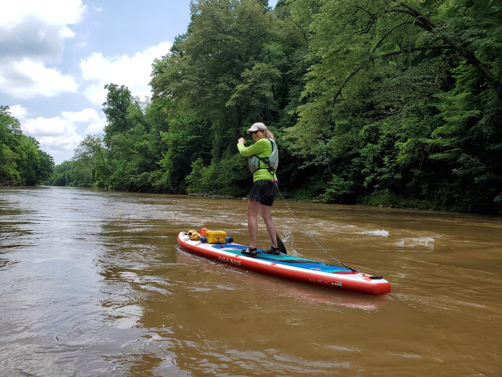
This was the first time we’ve been on a river when the water level was way higher than normal. I was watching the gauge the day before we did our paddle, and the water level was above the 75th percentile for the date using 12 years of history. I’ll admit that I was nervous given that we didn’t have experience in those conditions. But, I decided to face my fear and head up for a paddle.
We took a look at the river when we dropped off the car at the take out site, and the water was high, muddy, and fast. We were both concerned now. I was wondering if there would be big waves at the fish weirs, Anne was concerned about fallen trees causing problems, and we both were thinking about high e-coli levels. But, I really wanted to overcome my concerns, and convinced Anne that we’d be fine.

We ended up having a great time on the water. The fast water was a lot of fun with some choppy small waves where there would normally be exposed rocks. There were no big waves that I imagined. The high water presented two issues though. First, we didn’t want to swim due to e-coli concerns because the levels get very high after heavy rains wash the bacteria into the water. That made for a very hot day. The other problem was finding rocks to use a rest stops. All the fish weirs were completely submerged.
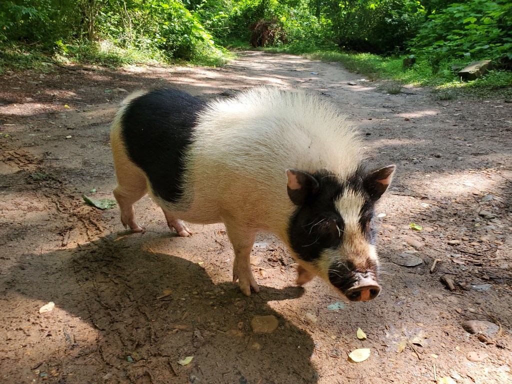
The most surprising thing for the day was this pig that was hanging around the put in area. It was very friendly and seemed a bit hungry too.
The river was very muddy for our trip

We did find a tricky spot where I dropped to my knees, not for a big drop or big waves, but for a swirling eddy current. There was a mostly submerged gravel bar on the left, so the water was flowing into a bank on the right with down trees in the water. It was pretty easy to paddle toward the gravel bar on the left, but doing so meant the front of the board would be in the circulating current that was heading upstream while the back of the board was still headed downstream in the strong current. It’s really easy to lose your balance in that situation. We ended up having our lunch on a tree trunk on the gravel bar and saw a kayaker that almost flipped in the strong eddy.
The take out point that we used was very close to Reformation Brewery’s Canton location, so we stopped in for a post paddle treat. Google’s satellite view is not current; there is a new parking area right by the river that is not shown on Google. If you use that take out, make sure that you check out how it looks from the river because it would be easy to miss otherwise. When we were there, an outfitter had a small sign by the water, and there are 4 or 5 wooden steps too.
