Summary
Distance: 9.2 miles
Put in: Paved parking with boat ramp. (map)
Take out: Paved parking with boat ramp. (map)
Guage level: 3.83 feet
Relevant guage: (here)
AllTrails map:
(here)
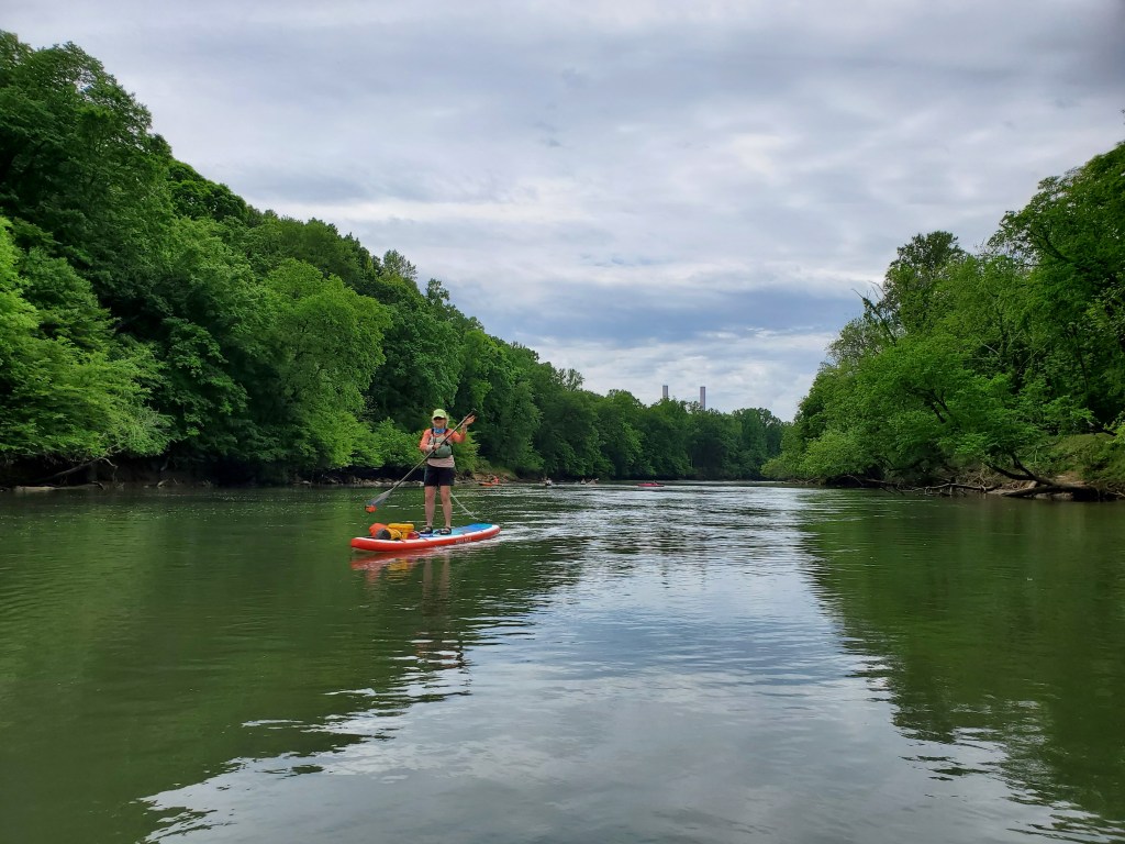
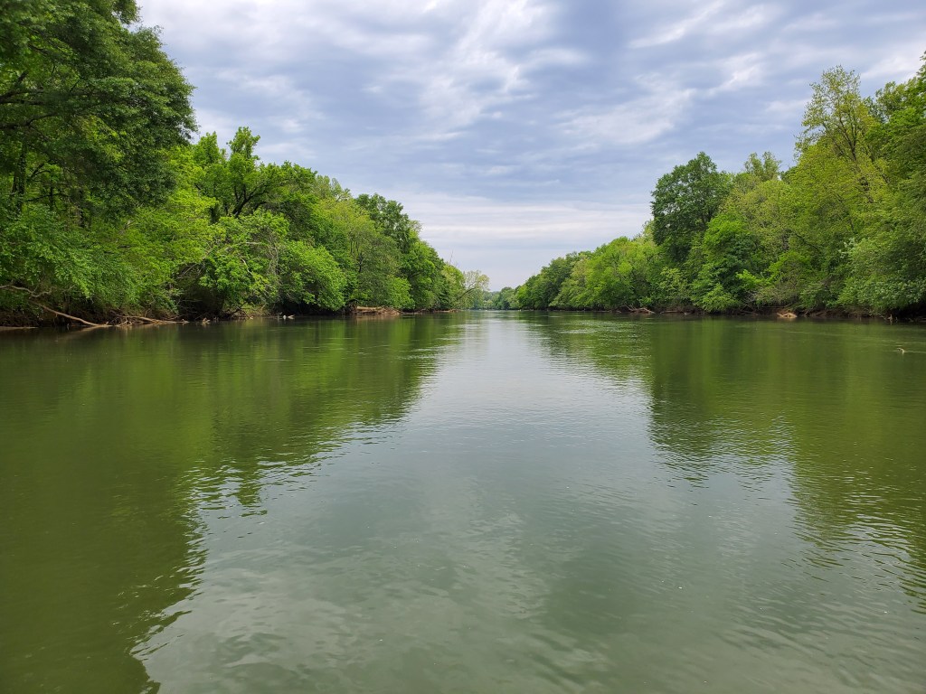
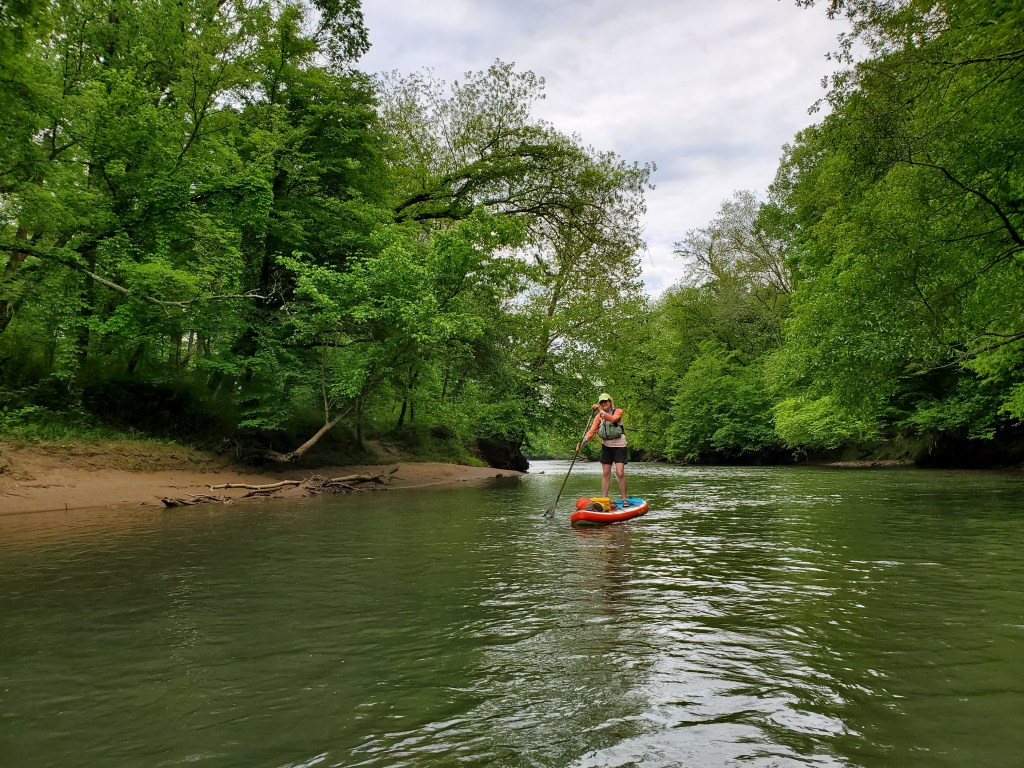
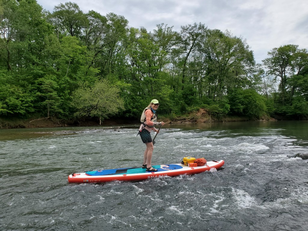
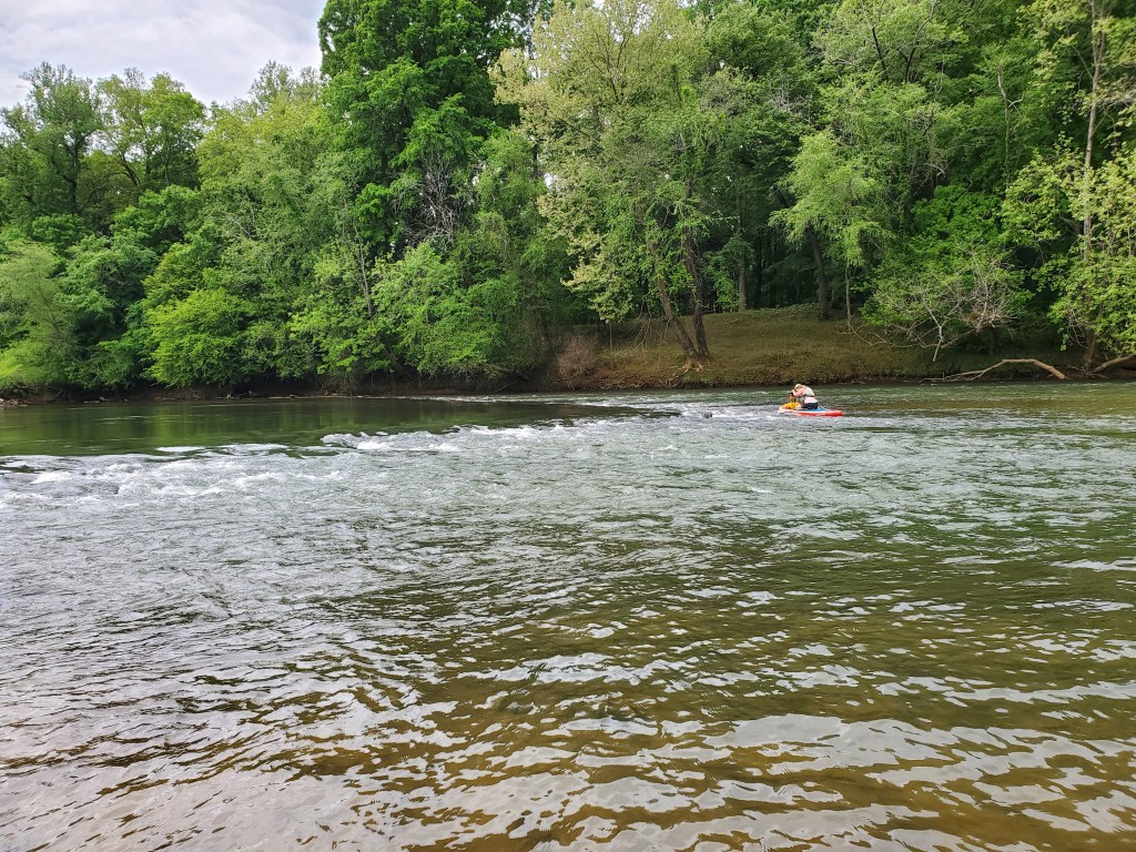
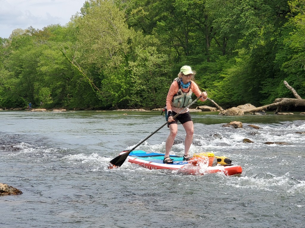
Today was our first time back on our paddle boards in months, so we decided to run a section of river that we’ve done before and has a comfortable distance. The Etowah here is Class 1 with small, easy rapids. Most of the rapids are caused by Native American fish weirs. The weirs are rocks piled into a v-shaped funnel that would concentrate fish in the narrow, downstream end. At the water level today, I was able to run all the rapids without catching my fin on any rocks. I have a single 2.5 inch whitewater fin on my NRS board. Anne caught her fin a few times, but her fin is a little larger than mine. This section is often only a few feet deep in places and it’s great fun on a paddle board to be able to see the bottom. There are often large numbers of fish too. I saw a gar today that was at least three feet long, so big that it startled me a bit. The fish seem to congregate in the rapids and I sometimes find myself distracted from picking my way through the rocks because I’m watching the fish. Today was really special because of a few interesting wildlife sightings that I’ll describe later.

I want to mention that the water level on this section of river can change dramatically if water is being released from the dam on Lake Allatoona. The river can rise as much as five feet during a release. In my experience, I don’t believe that releases happen on weekend days. The release schedule is available at this website and is usually available a day in advance. http://spatialdata.sam.usace.army.mil/hydropower/default.aspx
The first fish weir for the day is just below the put in, and is a fun way to start the day. We both ran the weir on river left through a small channel, and passed the first balance test of the day.
The day was really special because of two wildlife sightings. The first was a bald eagle. We saw it flying downstream and then again high in a tree on the river bank. I understand that there is a nesting pair of eagles on the Berry College property, and figure that this may have been one of those eagles. The really cool sighting of the day was a large rattlesnake, perhaps five feet long. Anne saw movement on the surface of the river in front of us heading from right to left. So we headed to the left side of the river to get a closer look, and, much to our surprise, the movement was a rattlesnake swimming across the river. When it got to the bank, it just froze among the roots.
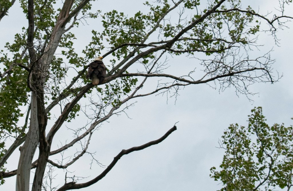
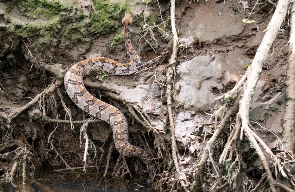
Photo: Anne Ledbetter

Thank you for these posts they give great information for paddlers. I’m not trying to pick you apart but you listed the ramp where you put in wrong and therefore might confuse some people if they don’t look at the map. You put in at Euharlee bridge ramp not Hardin bridge. The map you show is correct, just a simple mistake in the heading. Again keep posting these, they are great info
LikeLike
Thanks for the feedback. I think that I was referencing the EtowahRiverTrail site that seems to have changed from a river guide to a different blog. As I remember, that site referred to this section as “Hardin Bridge”. I fixed the title and removed the dead link.
LikeLike