Georgia Loop 3-day Backpacking Trip

Summary
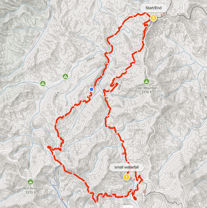
Day 1: 18.8 miles / 4,843 feet elevation gain AllTrails map
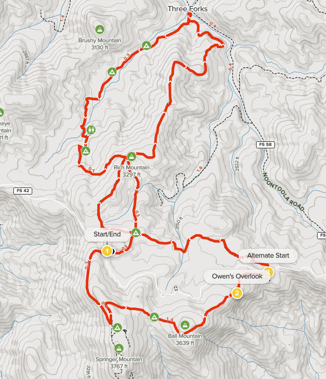
Day 2: 19.9 miles / 4,656 feet elevation gain AllTrails map
Day 3: 22.2 miles / 4,616 feet elevation gain AllTrails map
Total: 60.9 miles / 14,115 feet elevation gain
Type: Loop
Start/End: Paved lot. (map)

The Georgia Loop is a hike that combines parts of three trails, the Appalachian Trail, Duncan Ridge Trail and Benton MacKaye Trail, to make a loop. The terrain is rugged in places, water can be scarce in certain sections and campsites can be hard to find too. In other words, perfect for an adventure, and one that I’ve wanted to do for a while.

We hiked the loop in a counter-clockwise direction over Memorial Day weekend. By starting at Woody Gap and hiking counter-clockwise, we would be Duncan Ridge out of the way while we were fresh.

One of the more interesting aspects of the hike was how I came about hiking with a partner. I answered a question on a Reddit post and my answer mentioned that I was scouting Duncan Ridge for a future Georgia Loop hike. Someone replied to my post asking when I planned to hike and suggested Memorial Day weekend. After a few emails, we decided to do the hike together in four days. I didn’t know it at the time I started emailing them, but my hiking partner turned out to be a woman. My father-in-law had the best question about my plan to hike with a woman I had never met in person — “Does Anne know?”. As it turned out, our hiking preferences matched perfectly. We both liked to start hiking early, stop rarely and briefly when we do, and we hike at the same speed.

We did two things to make the hike easier. First, we left a car near the mid point of the loop, the spot where Benton MacKaye crosses Hwy 60. This allowed us to keep two days of food in the car making our packs lighter. Secondly, we stashed 10 liters of water in Mulky Gap a week before the hike in case water has hard to get. As it turned out, the water source was flowing at that location, but it was still easier to get water from our containers. It was very comforting to have certainty about water when hiking a long first day.

Continue reading “Georgia Loop 3-day Backpacking Trip”

Benton MacKaye Trail Dyer Gap to Watson Gap

Summary
Distance: 12.1 miles
Elevation gain: 1,970 feet
Type: Loop
Trailhead: Watson Gap. Dirt road, passenger car accessible (map)
AllTrails map (here)

We wanted to finish this part of the Benton MacKaye Trail (BMT), which is only 4.5 miles, to set up a 20 mile BMT backpacking trip that will take us to the Ocoee River in Tennessee. So, we put together a loop hike that used the South Fork Trail and the Pinhoti Trail as well as about 4 miles of Forest Service roads.

Overall, we both enjoyed the hike. It was a beautiful sunny Spring day, wildflowers were great, we found an intriguing historical marker, there are nice waterfalls on the South Fork of Jacks River, and we even took a quick dip in the river to cool off. Another plus is that we saw very few other people on the trail — a group of 3 horseback riders on Pinhoti, a group of 3 hikers on BMT near Dyer Gap, and a single hiker on South Fork.

But, you need to balance that against the rest of the hike. The Forest Service roads were pretty lightly traveled, but there was an occasional car or truck that passed. I think the biggest consideration about our loop is that the South Fork Trail and Pinhoti trails are old roads that see a fair amount of horse use. It was a dry day for our hike, but there were areas where the trails would have had a lot of mud on a wet day.

Continue reading “Benton MacKaye Trail Dyer Gap to Watson Gap”

Benton MacKaye Section 1 and Appalachian Trail Loop

Summary
Distance: 9.7 miles
Elevation gain: 1,980 feet
Type: Loop
Trailhead: gravel road, passenger car accessible (map)
AllTrails map (here)

Today’s hike was unusual in that we were able to hike in a loop while completing a Benton MacKaye section. We started from the AT parking lot on FS 42. Springer Mountain is where the Appalachian Trail starts, so the parking lot was mostly full. There are two other good starting points. The “Alternate Start” on the map is a Benton MacKaye trailhead with a small parking area. Three Forks on FS 58 is also a good alternative. If you start at Three Forks, just park along the road. FS 42 and FS 58 are both dirt roads, but are passenger car accessible. The other road that climbs to Winding Stair Gap, FS 77, has gotten very rough and should probably be avoided in a car.

Our hike was great fun even though we didn’t include the Springer Mountain summit to avoid other people due to Covid concerns. There are two shorter loops possible as well. I think that the Southern loop that includes Owen’s Overlook is the better of the two due to the great views and the Springer Mountain summit coolness factor.

Continue reading “Benton MacKaye Section 1 and Appalachian Trail Loop”