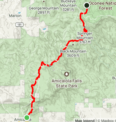
Summary
Distance: 25.7 miles
Elevation gain:5,580 feet
Type: Out and back
Start: Dirt road, passenger car accessible. (map)
AllTrails Day 1: map 10.3 miles
AllTrails Day 2: map 15.4 miles
It’s thru hiker season on the Appalachian Trail and I always enjoy staying at a shelter on the AT so I can meet and talk to the folks who are just starting their hike northward. This year an overnight stay at a shelter was not a good idea due to norovirus. According to the Georgia Appalachian Trail Club, the virus is very widespread on the trail throughout the Georgia section. To make matters worse, hand sanitizer doesn’t kill the virus, only diligent hand washing will protect you from the awful stomach bug. Of course, running water on the trail is difficult to find, making proper cleanliness all but impossible.
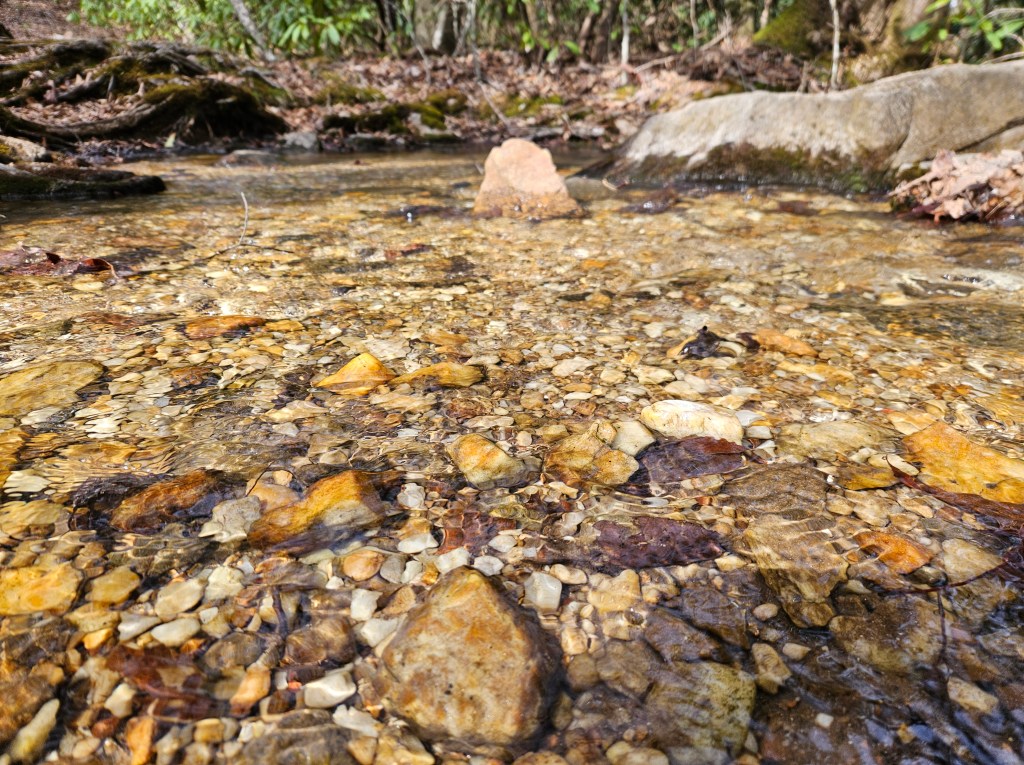
There is a really pretty campsite that I’ve seen before that was a prefect distance for me, so I decided to give that site a try instead of staying at a shelter. The site was great, right next to a small stream and somewhat protected from the strong winds that blew overnight.
After stopping by the Visitors Center to get my overnight parking pass, I headed up the long-term parking dirt road to leave my car. You can either walk up the dirt road to get to the top of the falls parking area or you can walk down the road to get to the trail that leads up to the top of the falls trailhead. I’ve always chosen walking up the road, but may not do that again because walking down to the car is always punishing at the end of a long hike.
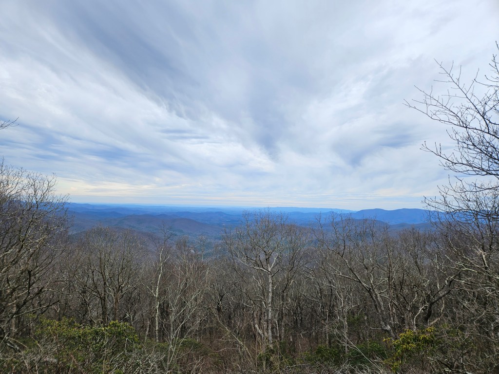
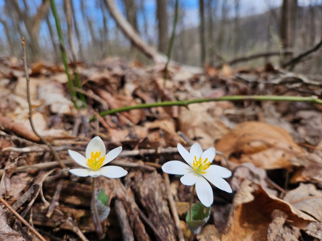
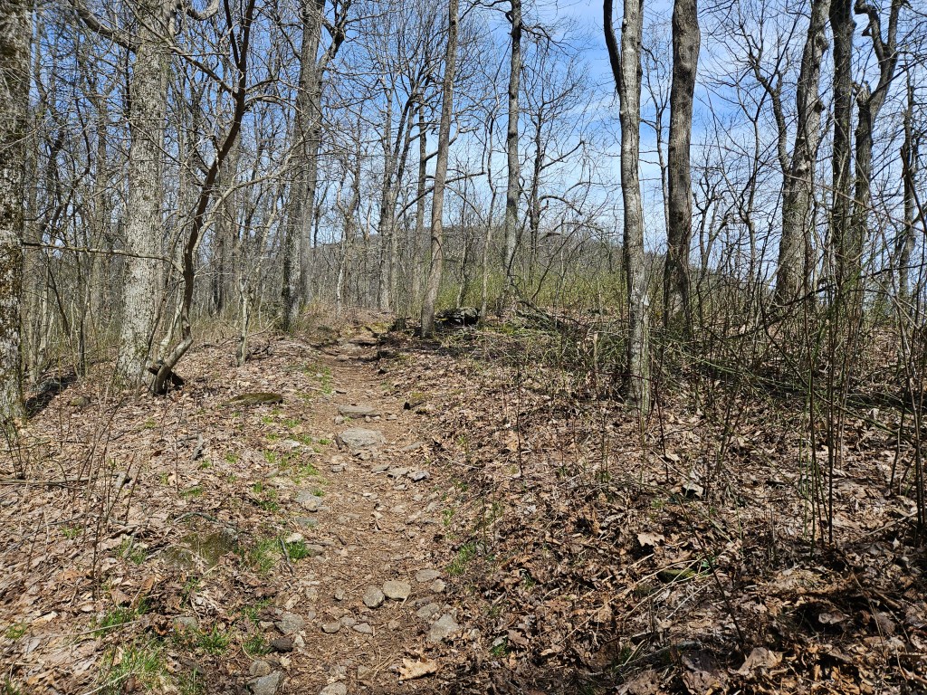
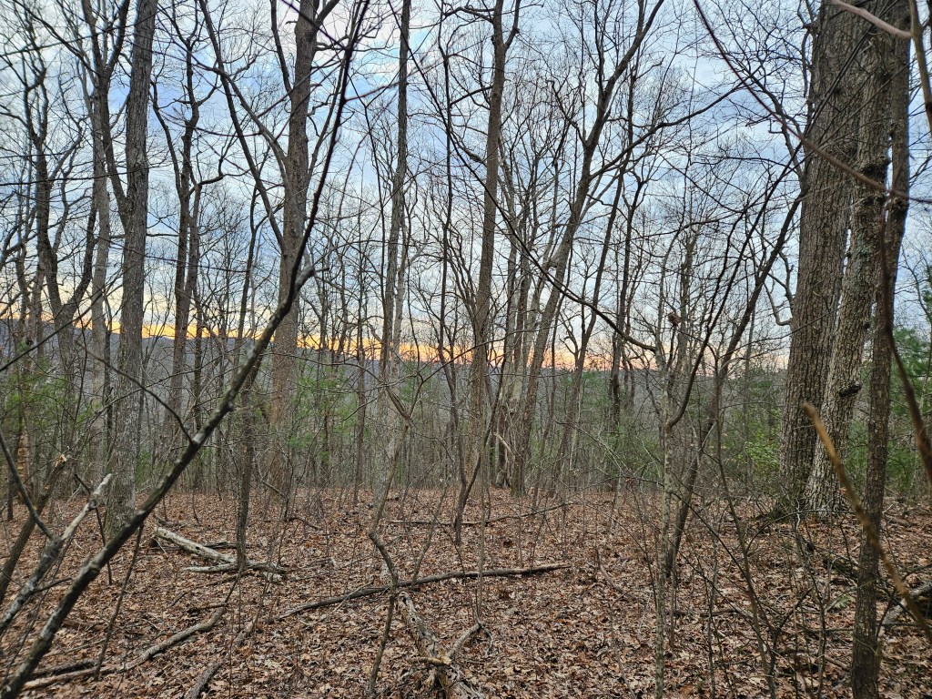
In late March, the woods are still in winter mode with very few leaves on the trees. The best part of this time of year is that the blood roots are starting to bloom.
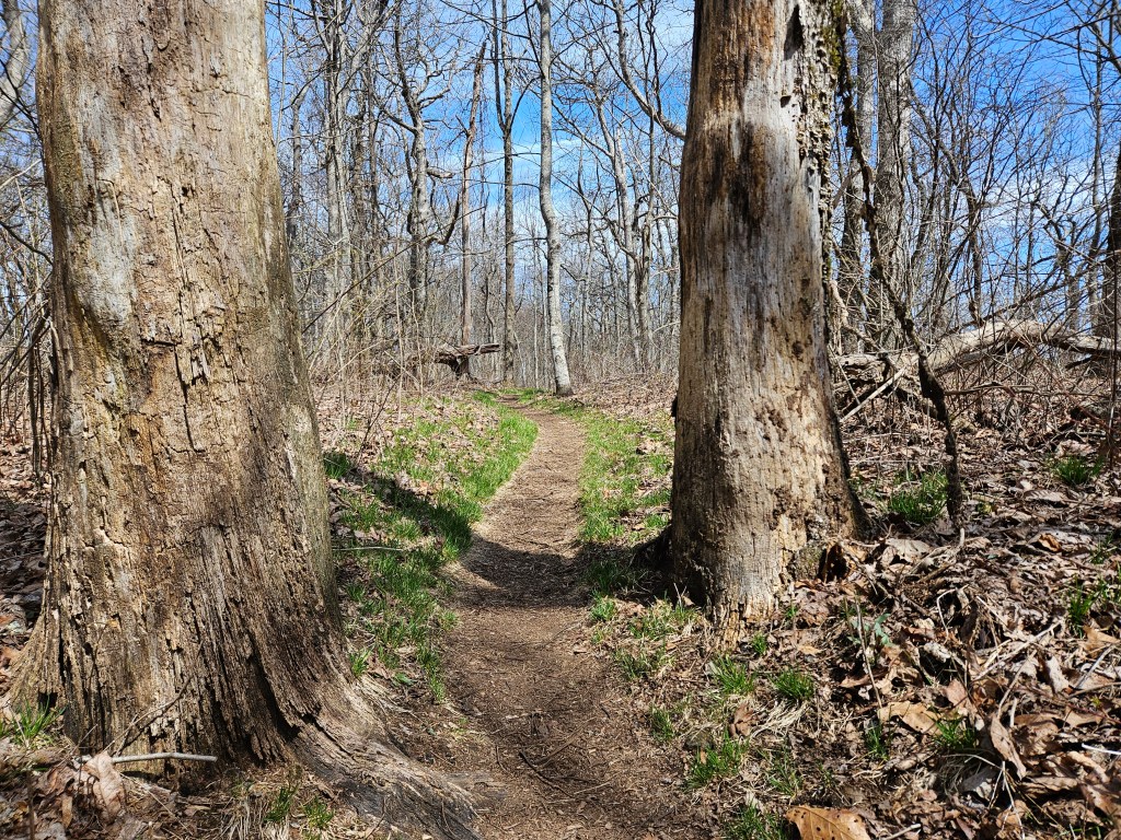
Here are a couple of views along the Approach Trail as I climbed up towards Springer Mountain.
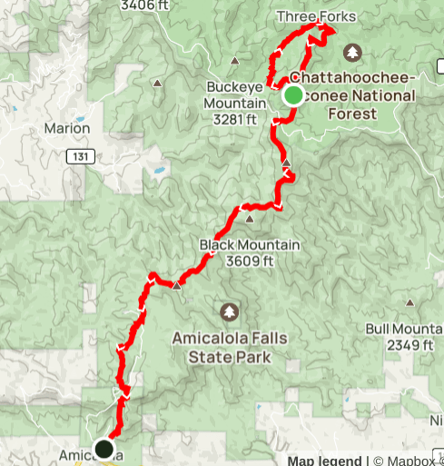
After I summited Springer Mountain, I continued on the Appalachian Trail to get to the campsite I wanted to try. The site is at about the 1.7 mile mark of the trail and is just past the first creek crossing on the AT.
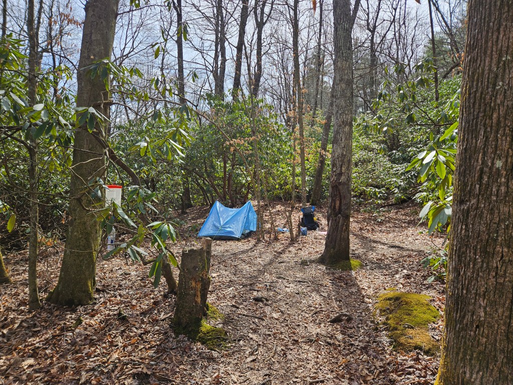
I was alone at this small site, so hiker midnight came early, I was in the tent by 7PM because it was fairly cold and windy. The wind really kicked up at night and the noise from the wind in the trees was loud and constant. It was actually pretty hard to stay asleep, and when I woke up, the light from the full moon almost looked like daylight, making it a bit confusing.
I got up early in the morning and had to decide on which way I would return to my car. I wanted to head north on the AT to a junction with the Benton MacKaye Trail (BMT). I would then head south on BMT and loop back to the AT. The issue for me was the cold and the wind. That section of BMT is quite exposed on a high ridge and I wasn’t sure I was prepared for that weather. But, while eating breakfast, the cold didn’t seem that bad, so I decided to take the BMT option. It was great. The forest is very open this time of year so the views across the terrain were very interesting. The wind was very strong in places, I felt myself being pushed sideways at times, but the experience of the wind was exhilerating.
The BMT brought me back to the Appalachian Trail and I headed southbound on the trail back past my campsite and onwards towards Springer Mountain and eventually Amicalola Falls State Park.