Summary
Day 1: 18.8 miles / 4,843 feet elevation gain AllTrails map
Day 2: 19.9 miles / 4,656 feet elevation gain AllTrails map
Day 3: 22.2 miles / 4,616 feet elevation gain AllTrails map
Total: 60.9 miles / 14,115 feet elevation gain
Type: Loop
Start/End: Paved lot. (map)
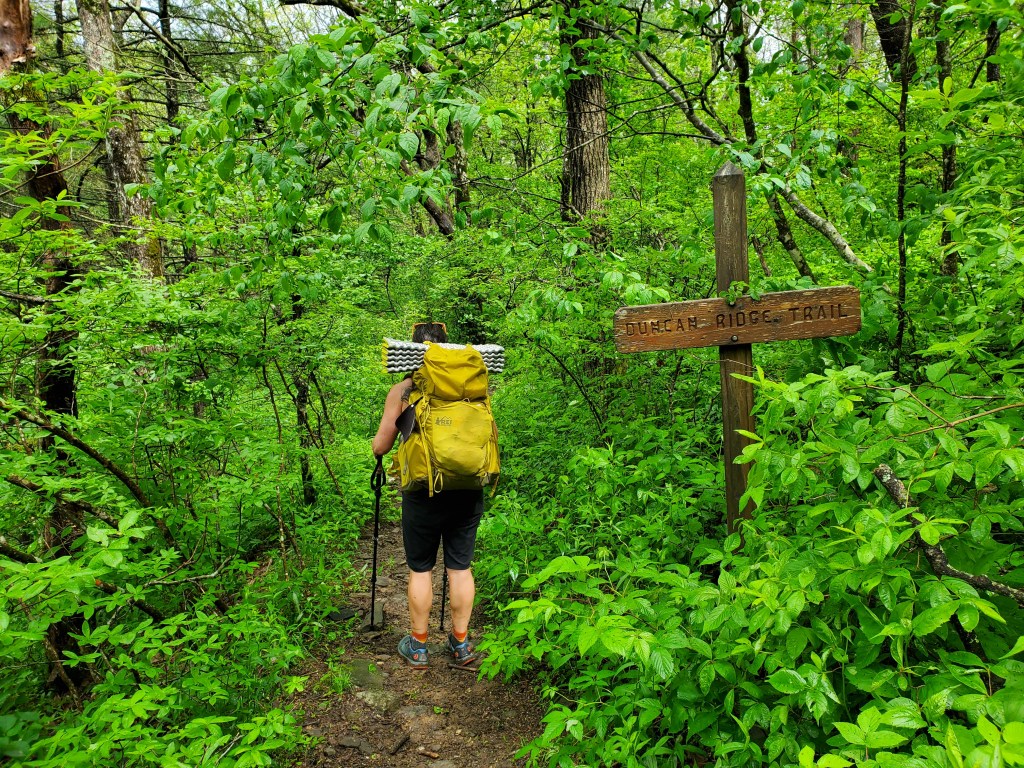
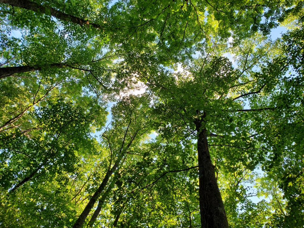
The Georgia Loop is a hike that combines parts of three trails, the Appalachian Trail, Duncan Ridge Trail and Benton MacKaye Trail, to make a loop. The terrain is rugged in places, water can be scarce in certain sections and campsites can be hard to find too. In other words, perfect for an adventure, and one that I’ve wanted to do for a while.
We hiked the loop in a counter-clockwise direction over Memorial Day weekend. By starting at Woody Gap and hiking counter-clockwise, we would be Duncan Ridge out of the way while we were fresh.
One of the more interesting aspects of the hike was how I came about hiking with a partner. I answered a question on a Reddit post and my answer mentioned that I was scouting Duncan Ridge for a future Georgia Loop hike. Someone replied to my post asking when I planned to hike and suggested Memorial Day weekend. After a few emails, we decided to do the hike together in four days. I didn’t know it at the time I started emailing them, but my hiking partner turned out to be a woman. My father-in-law had the best question about my plan to hike with a woman I had never met in person — “Does Anne know?”. As it turned out, our hiking preferences matched perfectly. We both liked to start hiking early, stop rarely and briefly when we do, and we hike at the same speed.
We did two things to make the hike easier. First, we left a car near the mid point of the loop, the spot where Benton MacKaye crosses Hwy 60. This allowed us to keep two days of food in the car making our packs lighter. Secondly, we stashed 10 liters of water in Mulky Gap a week before the hike in case water has hard to get. As it turned out, the water source was flowing at that location, but it was still easier to get water from our containers. It was very comforting to have certainty about water when hiking a long first day.
Day 1: Our plan was to hike on the Appalachian trail north from Woody Gap, and then turn left onto Duncan Ridge trail shortly before the summit of Blood Mountain. We would continue to Whiteoak Stomp for water (there is a good spring there) and then hike a little further to a campsite. The day as planned would have been about 14 miles. We got to Whiteoak Stomp with plenty of daylight left and decided to continue to Mulky Gap where we had the water stashed. I had been to Mulky Gap when I put out the water and wasn’t sure where to camp, but continuing on made a lot of sense. We ended up camping on the gated dirt road on the left as we entered the gap. This gated road is also the way to the water source. Mulky Gap road, the open dirt road through the gap, was busy with holiday weekend traffic, but I still managed to get to sleep. For future reference, there is a much better campsite a little past the gap where the trail runs along a spur of Akin Mountain, but it is small and does not have water. We had cell coverage with Verizon in the gap.
Day 2: In our pre-trip planning, our goal was getting to the car on Hwy 60 to get our food and some water, and then finding a place to camp. If we had camped at the originally planned site, the car would be at about the 20-mile point, but with the extra miles on day 1, we had an opportunity to push on to Bryson Gap on the Benton MacKaye Trail. There is a big climb on the way to Bryson Gap, but I’d camped there before with Anne and it is a very nice site, and was worth the effort.
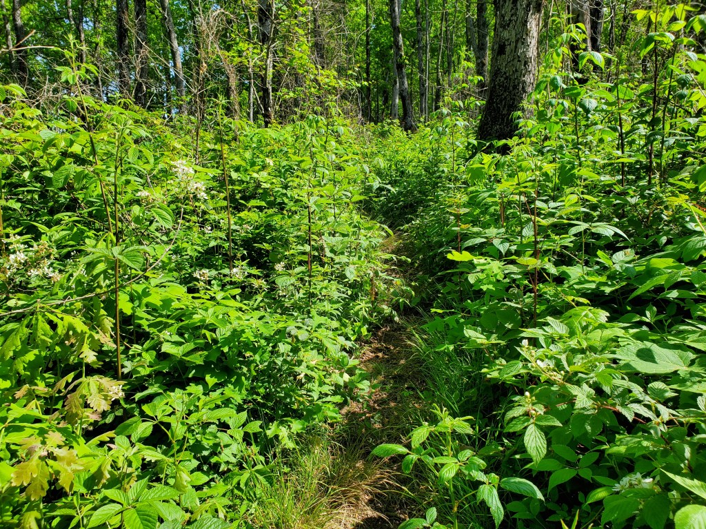
Duncan Ridge Trail was fairly overgrown in late May and I would question the wisdom of hiking between the AT and Fish Gap any later in the year. The blackberries were not terrible (yet), but poison ivy was encroaching on the trail.
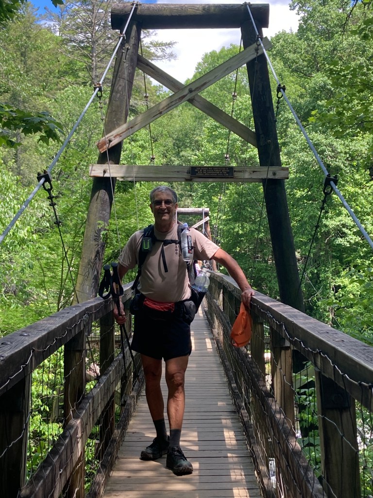
At Fish Gap, the character of Duncan Ridge changes dramatically. The trail has been rerouted and is relatively flat, open and fast until getting close to Rhodes Mountain. I scouted the water source at Sarvis Gap the week before we hiked and it was flowing nicely. We didn’t need to stop there, but I wanted to mention the water source. There is a small campsite in Sarvis Gap too. We did stop for water at a campsite that is north of Licklog Mountain on Benton MacKaye. The path to the water is to the right of the fire ring. It is a very steep hill down to the water, so we left our packs at the top. There are two other water sources along the way to Bryson Gap. The first is just south of Hwy 60 on the right side of the trail. It is a fairly small stream that seems like it could dry up. The other is on the left side of the trail just south of the “swinging bridge” over the Toccoa River. That stream seems like it would be reliable. We filtered some water here and took time to cool off too. The obvious water sources, Little Skeenah Creek just before crossing Hwy 60 and the Toccoa River, are probably not safe sources due to pollution.
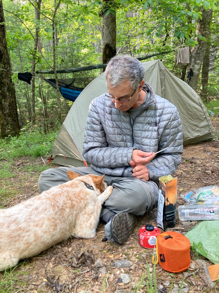
We camped right in Bryson Gap. There are a few sites to the left of the trail, one was occupied, but we could both set up in the gap, plenty of level ground for a tent and a good place to hand my hammock. The water source seems to be reliable. We had pretty good cell coverage on Verizon in the campsite, too.
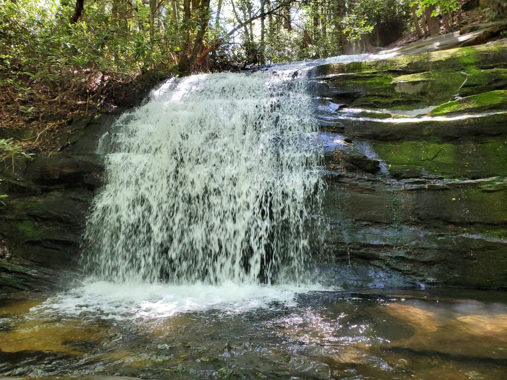
Day 3: We didn’t intend to finish the loop on the third day when we started in the morning, but realized pretty early on that we had a chance to complete the loop. We were dreading a big climb on Benton MacKaye from the campsite, but actually got most of it out of the way before reaching Bryson Gap, so we made good time to the junction with the Appalachian Trail. Long Creek Falls is a short side trip near the junction and is worth a stop.
After returning from the falls, it was pretty easy going to Hightower Gap on the Appalachian Trail. But, after that, the three and a half mile section between Hightower Gap and Cooper Gap was the toughest part of the day. This section goes over the infamous Sassafras Mountain, a mile long climb. The trail north of Cooper Gap is fast and fun all the way to Justus Creek. As the day progressed, we felt pretty good, and made the decision to evaluate our situation at Gooch Mountain Shelter on the AT, about 5 miles from the finish. At Gooch shelter, we felt good and were motivated to finish. I felt like I was performing a pit stop, quickly eating an energy bar and filtering water. Along the way to Woody Gap we each took a guess at a finish time, one had 6PM the other 5:30. We finished close to 5PM, beating both estimates!
This is an epic hike that should not be taken lightly. We were both well conditioned, had light packs, and had the luck of dry weather.
