Watson Gap to Thunder Rock Campground
Summary
Distance: 18.6 miles
Elevation gain: 3,527 feet
Type: One way with shuttle
Start: Dirt road, passenger car accessible. (map)
End: Dirt road, passenger car accessible. (map)
This hike completed our springtime goal of hiking all of the Benton MacKaye trail in Georgia, about 82 miles worth. We even chalked up a bonus 11 miles or so of trail in Tennessee. The Benton MacKaye was a big change from last week’s trip on the Appalachian Trail, we only passed one hiker on the trail during our two days. That solitude is a big appeal to the trail. As we got closer to the Tennessee end and the Tanasi trails, we did see a few mountain bikers and two trail runners, though.
Day 1
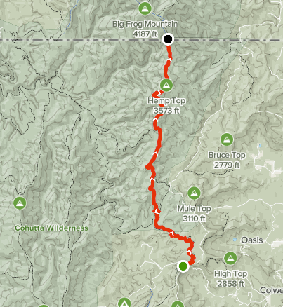
Watson Gap to Double Spring Gap
Distance: 8.3 miles
Elevation gain: 1,788 feet
AllTrails map (here)
Day 2
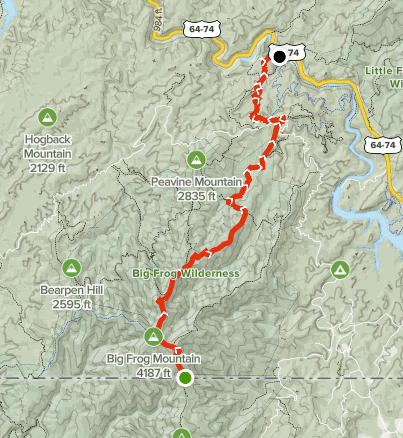
Double Spring Gap to Thunder Rock Campground
Distance: 10.3 miles
Elevation gain: 1,739 feet
AllTrails map (here)
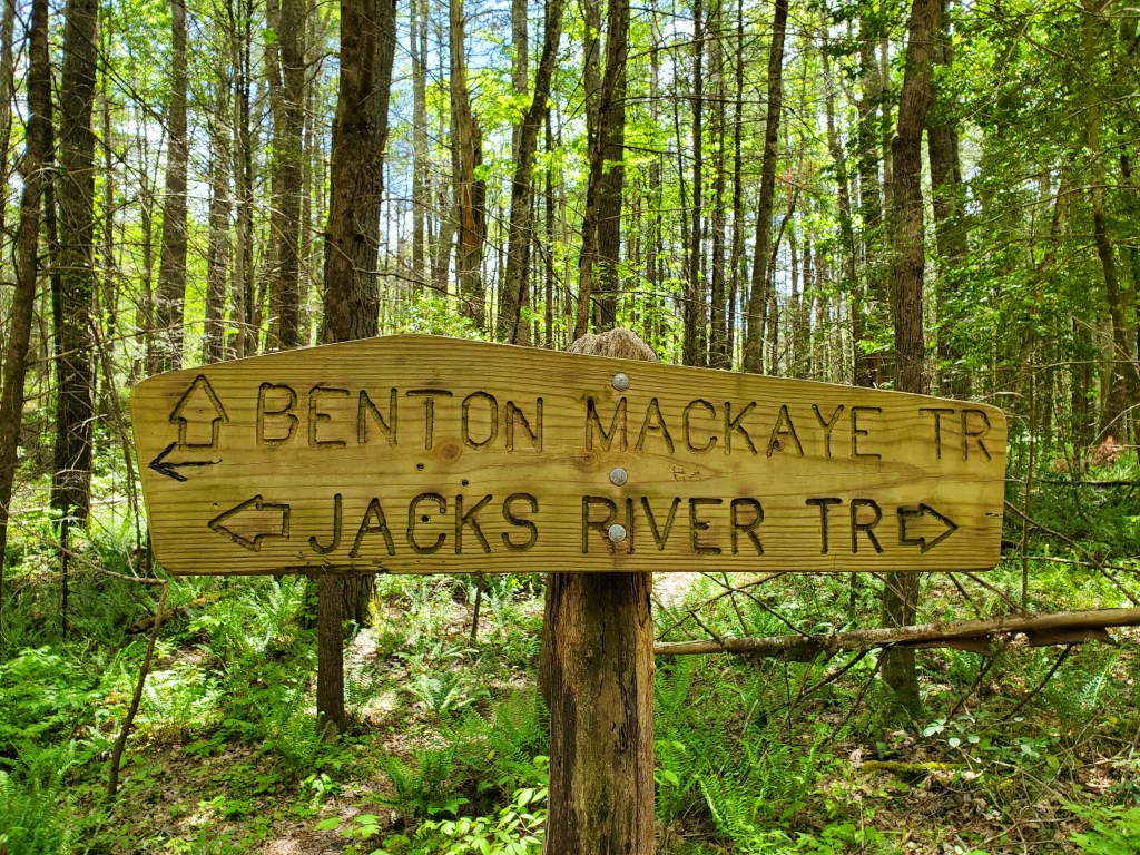
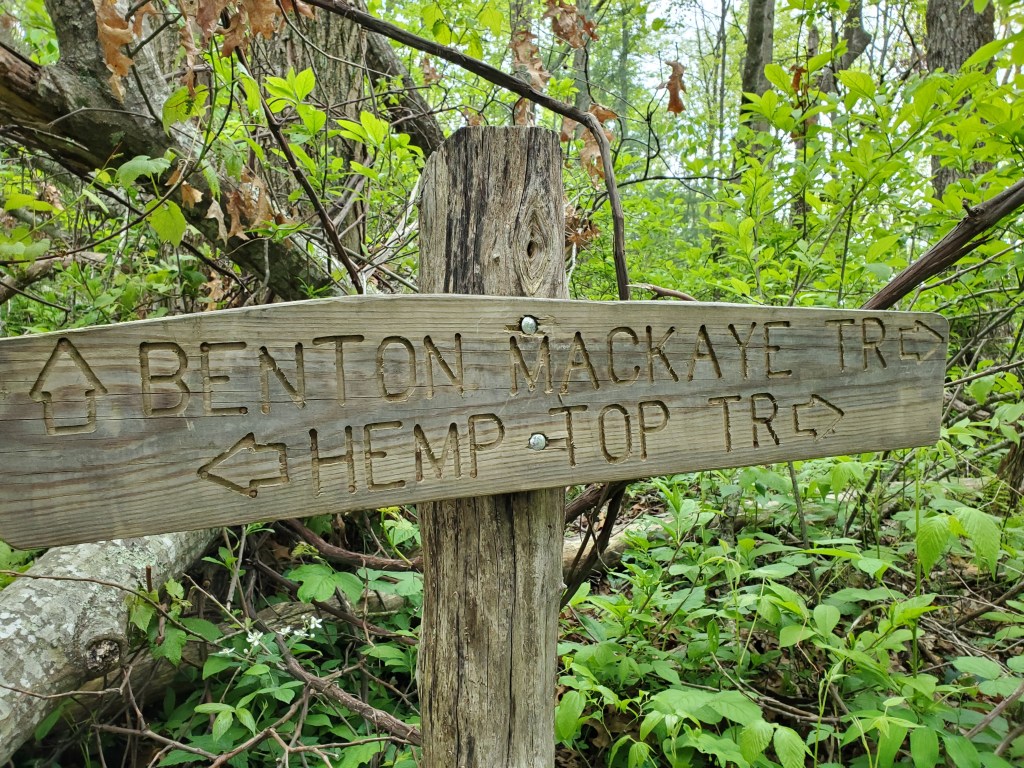
This trip took us through the Cohutta Wilderness where the trail is not blazed. For the most part, there were signs at trail junctions, but not always. It’s a good idea to have some sort of help with navigation, either the BMT Trail Guide or an electronic guide like Guthook. Even with Guthook gps navigation, we were confused for a bit in the Tanasi area.
The trail heads up Forest Service Rd #22 for about half a mile before turning left onto some really pretty trail.
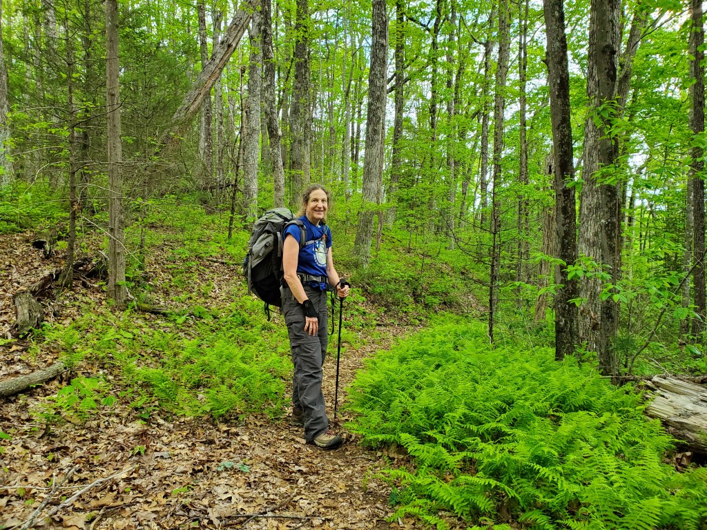
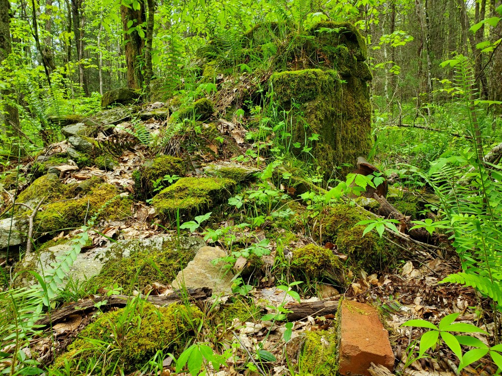
In less than a mile, there is a ruin on the right. The Benton MacKaye guide mentions the Joe Watkins home site that was occupied until the 1950’s.
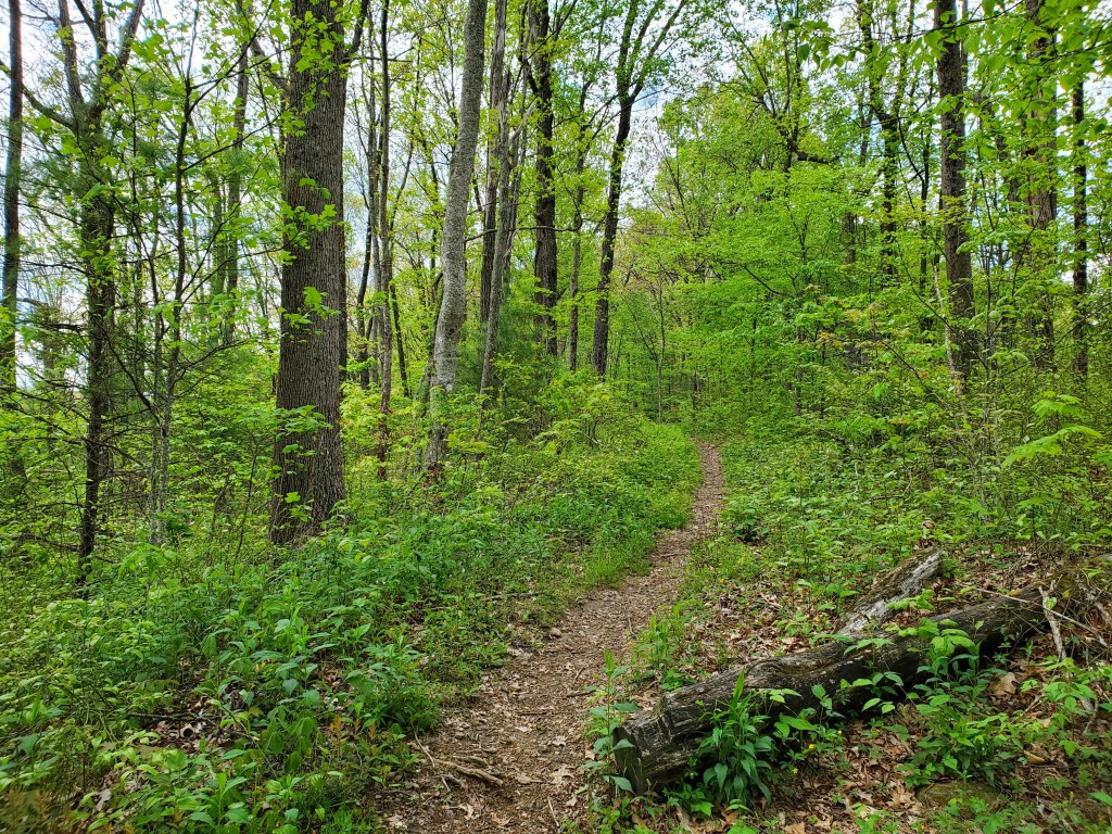
The Benton MacKaye trail eventually joins an old road that is also Hemp Top trail. The road remains fairly wide until it passes the summit of Hemp Top mountain where it narrows a bit as it makes its way to Double Spring Gap.
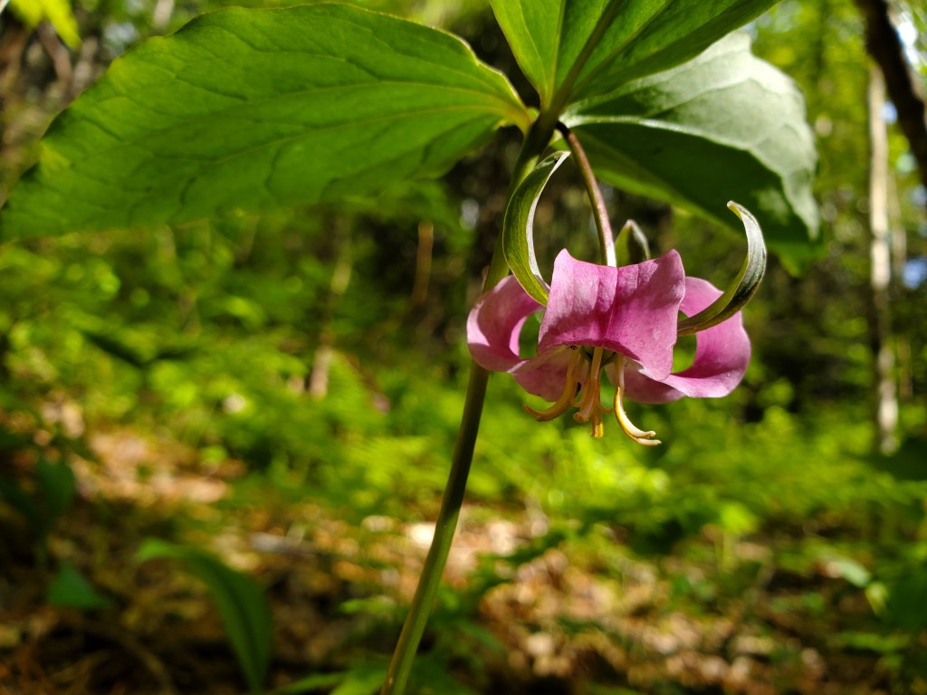
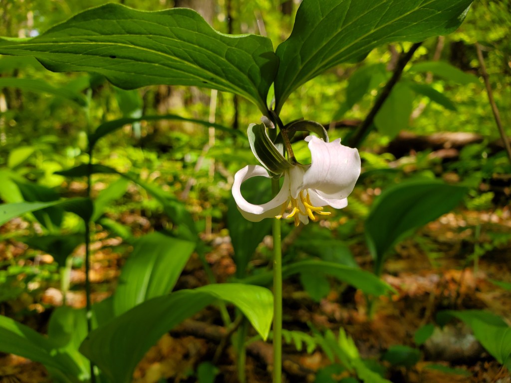
We spent the night at Double Spring Gap. There are campsites on both sides of the trail, and springs on both sides too (double spring). We used a site on the east side of the trail that was tucked into a clearing among rhododendrons that protected us from the northwest wind. Both springs were running pretty well, but both required scooping water into the filter bag. The evening light made the wildflowers in the area really special.
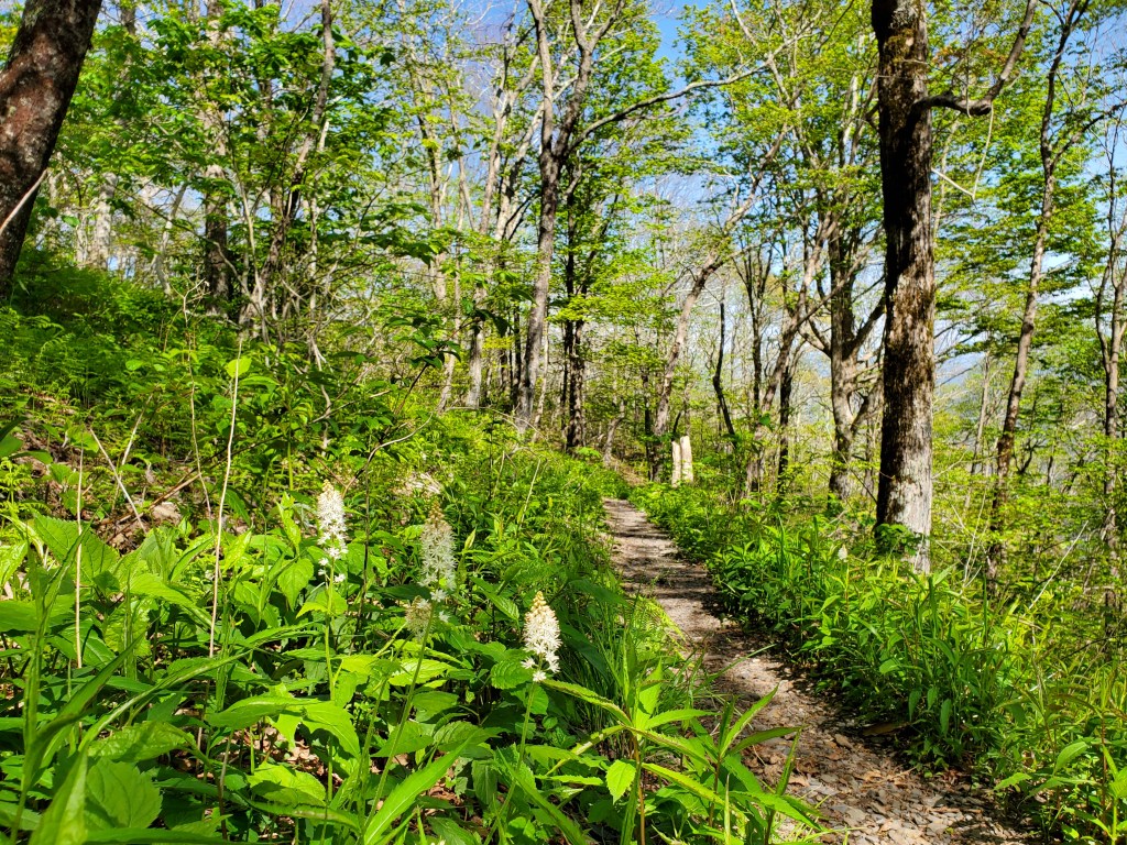
We started our second day by climbing Big Frog Mountain, which is about 1,000 feet of elevation gain in a mile. In sptie of the climb, the summit area of Big Frog was the highlight of the trip. It was very lush and green.

After Big Frog, it was mostly downhill to the Ocoee River and our finish at Thunder Rock Campground.

