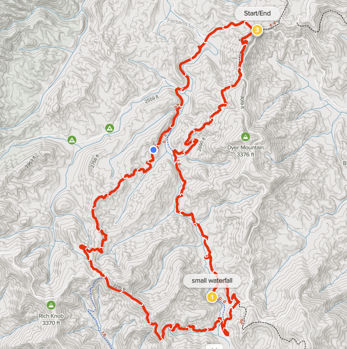
Summary
Distance: 12.1 miles
Elevation gain: 1,970 feet
Type: Loop
Trailhead: Watson Gap. Dirt road, passenger car accessible (map)
AllTrails map (here)
We wanted to finish this part of the Benton MacKaye Trail (BMT), which is only 4.5 miles, to set up a 20 mile BMT backpacking trip that will take us to the Ocoee River in Tennessee. So, we put together a loop hike that used the South Fork Trail and the Pinhoti Trail as well as about 4 miles of Forest Service roads.
Overall, we both enjoyed the hike. It was a beautiful sunny Spring day, wildflowers were great, we found an intriguing historical marker, there are nice waterfalls on the South Fork of Jacks River, and we even took a quick dip in the river to cool off. Another plus is that we saw very few other people on the trail — a group of 3 horseback riders on Pinhoti, a group of 3 hikers on BMT near Dyer Gap, and a single hiker on South Fork.
But, you need to balance that against the rest of the hike. The Forest Service roads were pretty lightly traveled, but there was an occasional car or truck that passed. I think the biggest consideration about our loop is that the South Fork Trail and Pinhoti trails are old roads that see a fair amount of horse use. It was a dry day for our hike, but there were areas where the trails would have had a lot of mud on a wet day.
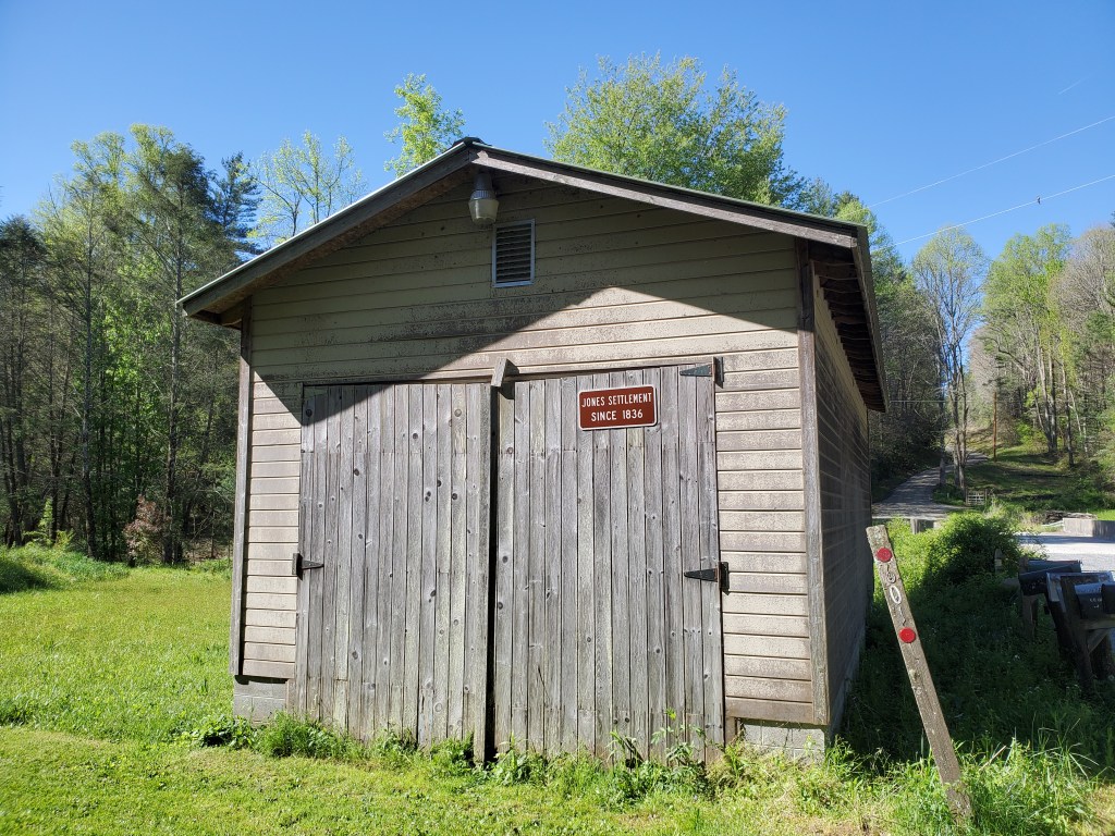
We started the hike by heading west from Watson Gap on a dirt road that would take us down to Jacks River and then to the South Fork Trail. When we got near the river, we learned that area was home to the Jones Settlement in the 1800’s.
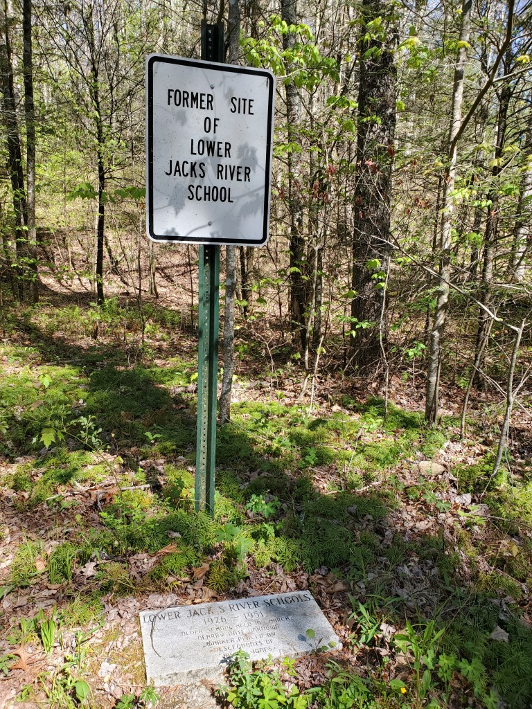
A short while after that, we found this marker that indicated that there was a school from 1926 to 1951. Not much remains except a dug out area where the building stood and a few bricks.
About a half mile past the school marker, you need to turn left onto an unmarked dirt road that leads to the South Fork Trail. There are two wooden posts at the corner that held a sign that is no longer there. We missed the turn, but quickly figured out our error. I do like my GPS app.
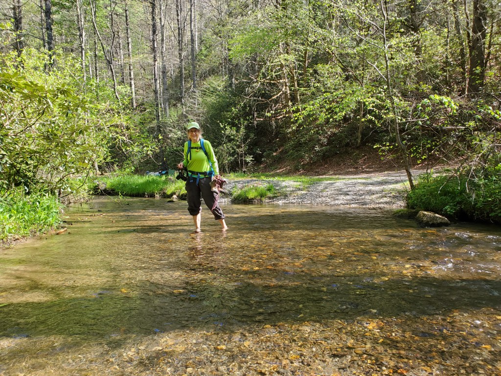
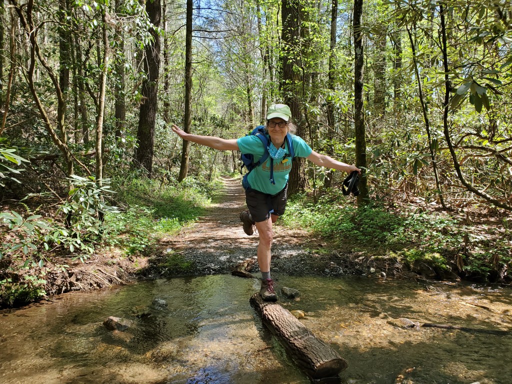
There is a wide but shallow ford of the West Fork of Jacks River at the start of the South Fork Trail.
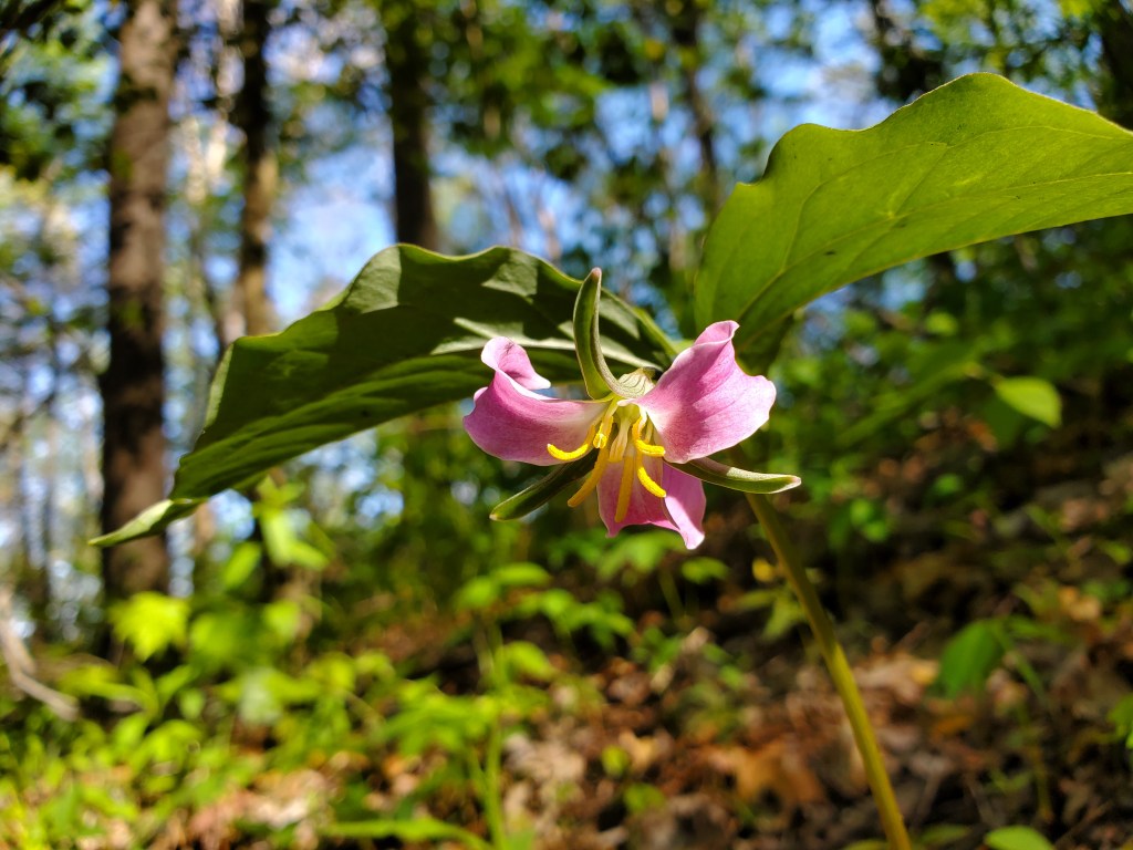
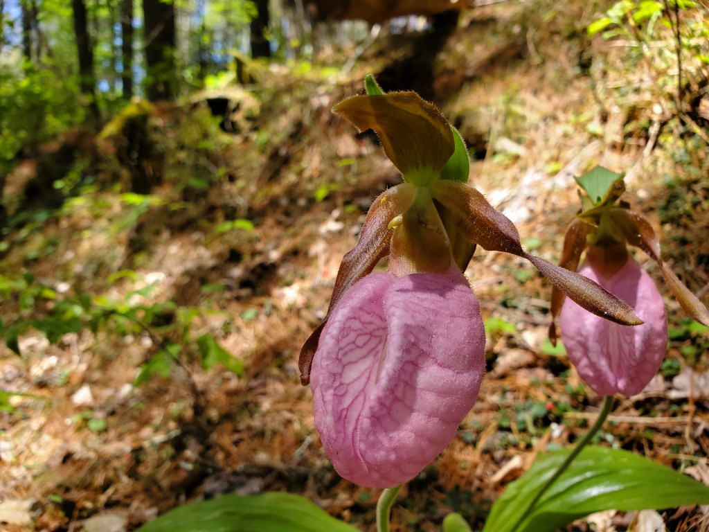
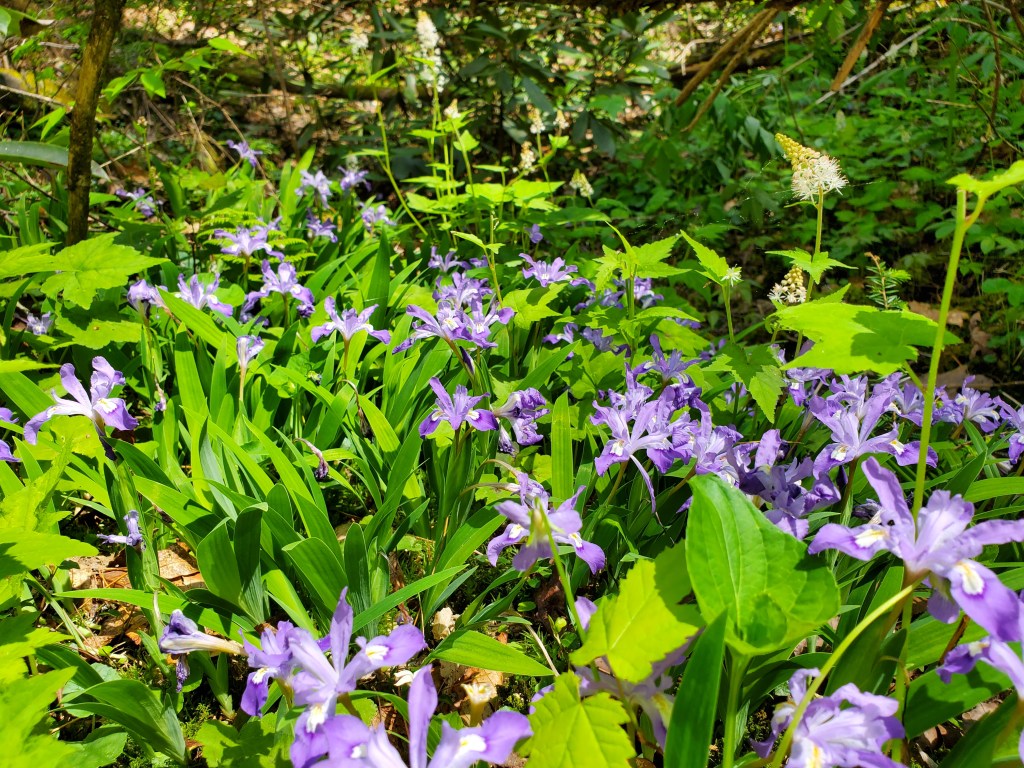
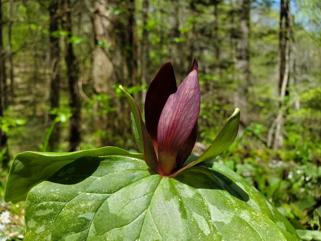
The South Fork Trail is on an old road, and is easy to follow. There was a nice selection of wildflowers along the way.

The Pinhoti Trail joins the South Fork Trail. Turn right, onto the Pinhoti.
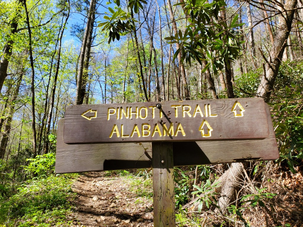
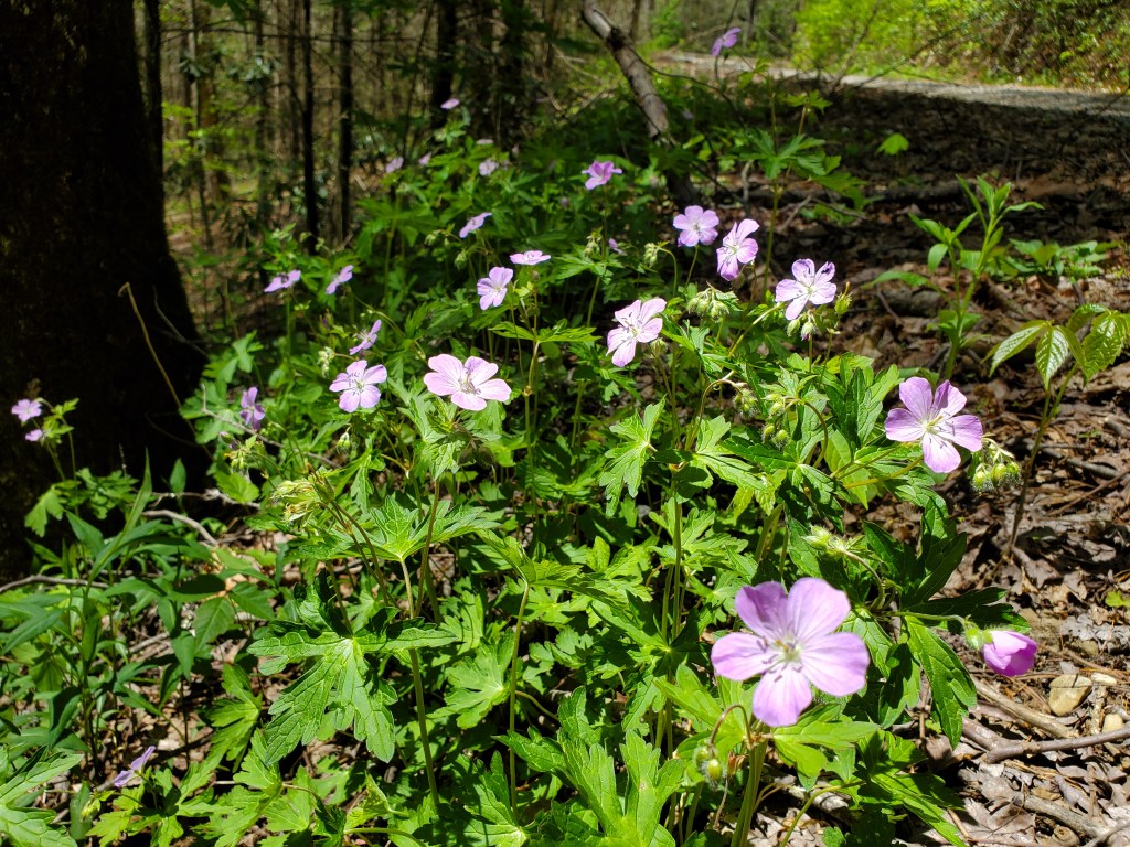
The Pinhoti is also an old road. The trail climbs up to Forest Service road 64 and becomes more of a forest service road itself as it approaches the top. The trail sees a lot of horse traffic and could easily become muddy in wet conditions. Even so, there are interesting wildflowers along the way and occasional views.

Once the Pinhoti reaches FS 64, it’s about a two and a half mile dirt road walk to the spot where the Benton MacKaye trail crosses the road. The road wasn’t that bad of a walk and there were some partial views to the south through the trees. We ended up having first lunch along Jacks River, near the Forest Service’s Jacks River Campground.
It was a very nice change to get on the Benton MacKaye trail and its narrow single track.

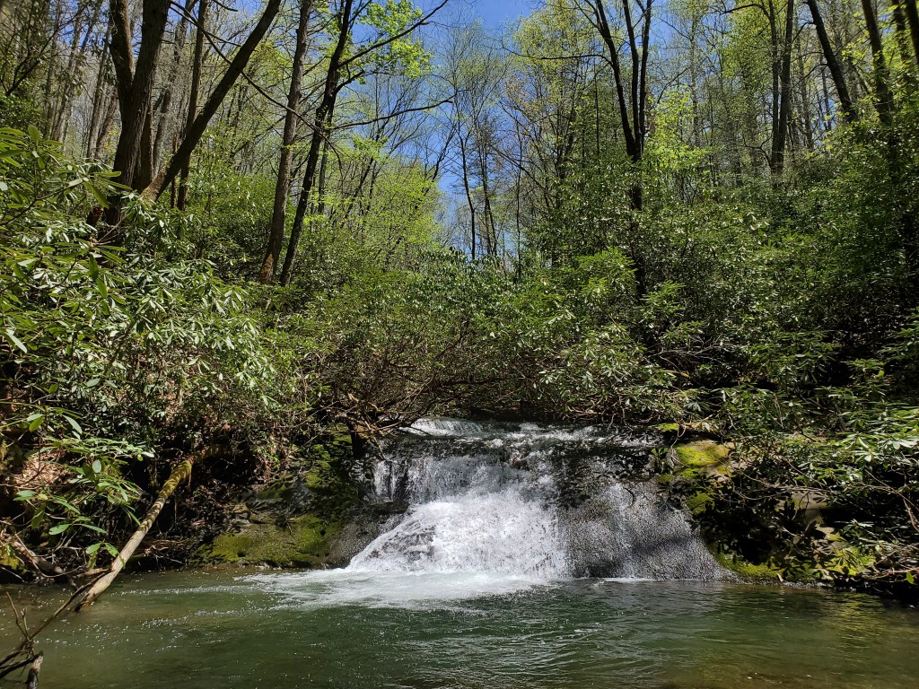
In about four tenths of a mile, Benton MacKaye joins South Fork Trail. We decided to take a little side trip to see a waterfall on the Jacks River. Guidebooks mention a 20-foot high falls, so it seemed like a fun addition to our day.

We turned left onto South Fork Trail and headed basically south to find the waterfalls. There is a nice little campsite at the trail junction.
As it turns out, there are two falls close together. Both have small access trails leading off the main trail. The first falls is the smaller of the two, but has a much better view and is more accessible. There’s even a nice pool where you could swim in warmer weather. The larger falls is mostly obscured by fallen trees, but is still interesting. The photo below is the smaller falls.
After the falls, we headed north on South Fork trail to its second junction with Benton MacKaye. South Fork was an old road all the way to BMT, and the BMT was on an old road for most of the way back to Watson Gap. The last half mile or so was very nice single track though.
There were great Spring flowers along both South Fork Trail and the Benton MacKaye trail.